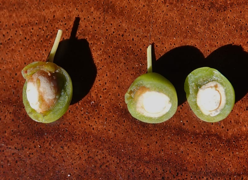
Prunus pumila, C. Davidson 14083--ID. Valley Co. Warm Lake Rd. 3 Aug 2020 (3).JPG
Native to Colorado, Illinois, Indiana, Iowa, Kansas, Maine, Manitoba, Massachusetts, Michigan, Minnesota, Montana, Nebraska, New Brunswick, New Hampshire, New Jersey, New York, North Dakota, Ohio, Ontario, Oregon, Pennsylvania, Québec, Saskatchewan, South Dakota, Tennessee, Utah, Vermont, Virginia, Wisconsin, Wyoming; introduced into Central European Russia, West Siberia (source: POWO). Flora of the World documents 1 occurrence across 1 country.
Location
United States, Idaho, Valley
44.158, -116.118361
Location Remarks
Highway 55 c. 10 km north of the bridge at Banks. Mixed conifer forest along the N. Fork Payette River.
Collectors
Christopher Davidson, Charlotte M. Taylor, Roy E. Gereau, Sharon R. Christoph
Notes
Exposed, steep, sandy, roadside bank in mixed conifer forest (ponderosa, D. fir, lodgepole). Diminutive shrub 0.2-0.3 m. Fruiting branches parallel to the ground and ascending.
Kingdom
Plantae
Phylum
Tracheophyta
Class
Magnoliopsida
Order
Rosales
Family
Rosaceae
Genus
Prunus
Specific Epithet
pumila
Authorship
L.
What is EDGE?
Evolutionary distinctiveness
Lower
ED 4.0
Part of a well-represented branch of the plant tree of life, with many close relatives.
Threat status
Modelled estimate
EDGE score
0.4
Global rank
#119,782 of 335,497
Top 36%
Extinction probability
11%