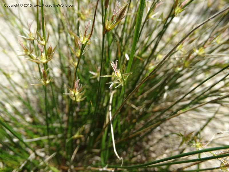
Juncus parryi, Davidson, C 12556--Idaho. Valley Co. FS Rd. 431. 11 Jul 2014. DSC09386 (17).JPG
Native to Alberta, British Columbia, California, Colorado, Idaho, Mexico Northwest, Montana, Nevada, New Mexico, Oregon, Utah, Washington, Wyoming (source: POWO). Flora of the World documents 2 occurrences across 1 country.
Location
United States, Idaho, Valley
44.158, -116.118361
Location Remarks
Highway 55 c. 10 km north of the bridge at Banks. Mixed conifer forest along the N. Fork Payette River.
Collectors
Christopher Davidson, Sharon R. Christoph
Notes
Tight clumps in sandy places along the road.
Location
United States, Idaho, Idaho
45.244, -115.588639
Location Remarks
1.9 km N of Warren Summit on FSR 340, at Mayflower Creek Bridge. Elev. 1904 m.
Collectors
No collectors specified
Kingdom
Plantae
Phylum
Tracheophyta
Class
Liliopsida
Order
Poales
Family
Juncaceae
Genus
Juncus
Specific Epithet
parryi
Authorship
Engelm.
What is EDGE?
Evolutionary distinctiveness
Lower
ED 4.7
Part of a well-represented branch of the plant tree of life, with many close relatives.
Threat status
Modelled estimate
EDGE score
0.5
Global rank
#107,068 of 335,497
Top 32%
Extinction probability
12%