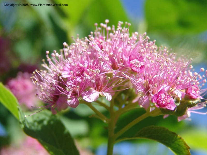
Spiraea densiflora, CDavidson10957--ID. Valley Co. Warren Wagon Rd jct with Bear Pete Rd. 9 Jul 06. 045.jpg
Native to Alberta, British Columbia, California, Idaho, Montana, Oregon, Washington, Wyoming (source: POWO). Flora of the World documents 4 occurrences across 1 country.
Location
United States, Idaho, Valley
44.158, -116.118361
Location Remarks
Highway 55 c. 10 km north of the bridge at Banks. Mixed conifer forest along the N. Fork Payette River.
Collectors
Location
United States, Idaho, Shoshone
47.086694, -116.11375
Location Remarks
Hobo Cedar Grove (Hwy 3 to Clarkia, E on FR 321, Hobo Pass along Merry Cr. to FR 321). Elev. 1367 m.
Collectors
Christopher Davidson, Sharon R. Christoph
Notes
Open, sunny roadbank in thin fir/hemlock forest. Shrub 0.5 m. Flowers deep rose.
Location
United States, Idaho, Idaho
45.244, -115.588639
Location Remarks
1.9 km N of Warren Summit on FSR 340, at Mayflower Creek Bridge. Elev. 1904 m.
Collectors
Location
United States, Idaho, Valley
44.158, -116.118361
Location Remarks
Highway 55 c. 10 km north of the bridge at Banks. Mixed conifer forest along the N. Fork Payette River.
Collectors
No collectors specified
Kingdom
Plantae
Phylum
Tracheophyta
Class
Magnoliopsida
Order
Rosales
Family
Rosaceae
Genus
Spiraea
Specific Epithet
splendens
Authorship
Baumann ex K.Koch
What is EDGE?
Evolutionary distinctiveness
Lower
ED 2.3
Part of a well-represented branch of the plant tree of life, with many close relatives.
Threat status
Modelled estimate
EDGE score
0.2
Global rank
#207,095 of 335,497
Top 62%
Extinction probability
9%