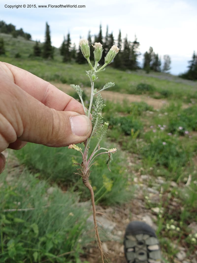
Chaenactis douglasii, Mansfield, D 12-640--ID. Bear Lake Co. Mt. Sherman. 13 Jul 2012. DSC03679 (67).JPG
Native to Alberta, Arizona, British Columbia, California, Colorado, Idaho, Montana, Nevada, New Mexico, North Dakota, Oregon, South Dakota, Utah, Washington, Wyoming (source: POWO). Flora of the World documents 5 occurrences across 1 country.
Location
United States, Idaho, Bear Lake
42.431667, -111.562722
Location Remarks
Sherman Peak Area. Follow North Canyon Rd. (Forest Road 401) ) from Hwy 36 near E entrance to Emmigration Canyon. At intersection of Bartlett Lake and North Canyon Rd. (1.9 mi. from Hwy 36), go W on N Canyon Rd. past Mill Hollow Rd. At 4.7 mi. from Hwy 36 turn N at Meadow Creek (FR 425). Stop along Meadow Creek, ca. 0.8 mi. N of North Canyon Rd.
Collectors
Bob McCoy, Brittni Brown, Christopher Davidson, Sharon R. Christoph
Notes
Open subalpine meadow with mixed forbs, including: lupine, Rudbeckia, Potentilla gracillus, Carex hoodii. On limestone. Lvs pinnatified (1-3). Receptacle naked. Fls off-white, corolla petals 5-toothed, discoid flowers. Pappus scales w/out midrib, mostly 10-16.
Location
United States, Idaho, Fremont
44.289333, -111.459389
Location Remarks
Intersection of Hwy 20 and Pinehaven Rd. ca. 16 km S of bridge in Island Park and 26 km N of Main St. in Ashton. Elev. 1868 m.
Collectors
Christopher Davidson, Sharon R. Christoph
Notes
Full sun in stunted fir forest, scree of exposed basalt shoulder. Flowers lavender.
Location
United States, Idaho, Boise
44.083139, -115.754194
Location Remarks
Ca. 4.2 km N of Banks-Lowman Rd (Hwy 17) on Scott Mtn Lookout Rd. (FSR 555BC). Elev. 1170 m.
Collectors
No collectors specified
Location
United States, Idaho, Butte
43.961722, -112.750611
Location Remarks
On Hwy 22 W of Dubois and 3.5 km W of Hwy 28 junction. Elev. 1557 m. (Close to Butte/Clark Co. line.)
Collectors
Christopher Davidson, Sharon R. Christoph
Notes
Roadside strip in open farm country of gently rolling hills.
Location
United States, Oregon, Malheur
43.776083, -117.754528
Location Remarks
Hwy 20, ca. 37 km east of Frances St. in Juntura, in Simmons Gulch. Elev. 852 m.
Collectors
Kingdom
Plantae
Phylum
Tracheophyta
Class
Magnoliopsida
Order
Asterales
Family
Asteraceae
Genus
Chaenactis
Specific Epithet
douglasii
Authorship
(Hook.) Hook. & Arn.
What is EDGE?
Evolutionary distinctiveness
Lower
ED 0.9
Part of a well-represented branch of the plant tree of life, with many close relatives.
Threat status
Modelled estimate
EDGE score
0.1
Global rank
#276,645 of 335,497
Top 83%
Extinction probability
10%