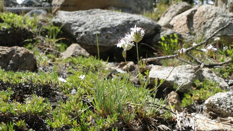
Arenaria congesta, C. Davidson 11767--ID. Idaho Co. Josephine Lk Rd . 27 July 2010. 001 (66).jpg
Native to Alberta, California, Colorado, Idaho, Montana, Nevada, Oregon, Saskatchewan, Utah, Washington, Wyoming (source: POWO). Flora of the World documents 6 occurrences across 1 country.
Location
United States, Idaho, Idaho
45.244, -115.588639
Location Remarks
1.9 km N of Warren Summit on FSR 340, at Mayflower Creek Bridge. Elev. 1904 m.
Collectors
No collectors specified
Location
United States, Idaho, Boise
44.083139, -115.754194
Location Remarks
Ca. 4.2 km N of Banks-Lowman Rd (Hwy 17) on Scott Mtn Lookout Rd. (FSR 555BC). Elev. 1170 m.
Collectors
Christopher Davidson, Sharon R. Christoph
Notes
Gravelly-sandy roadbank at a saddle.
Location
United States, Idaho, Bear Lake
42.431667, -111.562722
Location Remarks
Sherman Peak Area. Follow North Canyon Rd. (Forest Road 401) ) from Hwy 36 near E entrance to Emmigration Canyon. At intersection of Bartlett Lake and North Canyon Rd. (1.9 mi. from Hwy 36), go W on N Canyon Rd. past Mill Hollow Rd. At 4.7 mi. from Hwy 36 turn N at Meadow Creek (FR 425). Stop along Meadow Creek, ca. 0.8 mi. N of North Canyon Rd.
Collectors
Bob McCoy, Brittni Brown, Christopher Davidson, Sharon R. Christoph
Notes
Open subalpine meadow with mixed forbs, including: lupine, Rudbeckia, Potentilla gracillus, Carex hoodii. Plant > 7 cm tall. Basal leaves long, > 3cm, filiform, stiff and needle-like. Sepals < 4mm long. Capsule with 6 valves.
Location
United States, Idaho, Idaho
45.244, -115.588639
Location Remarks
1.9 km N of Warren Summit on FSR 340, at Mayflower Creek Bridge. Elev. 1904 m.
Collectors
No collectors specified
Location
United States, Idaho, Blaine
43.34475, -114.382972
Location Remarks
Rock Creek Ranch, a Nature Conservancy reserve. Main access road ca. 1 km north of Hwy 20. 1494 m elev.
Collectors
Christopher Davidson, Sharon R. Christoph, Clark Shafer
Notes
Upland intermountain steppe over weathered basalt. North slope above Rock Creek and environs. Surface-dry clay soil between Artemisia shrubs.
Location
United States, Idaho, Valley
44.158, -116.118361
Location Remarks
Highway 55 c. 10 km north of the bridge at Banks. Mixed conifer forest along the N. Fork Payette River.
Collectors
Christopher Davidson, Sharon R. Christoph
Notes
Dry cobblestone streambank and seasonally dry meadow. Mixed conifer forest.
Kingdom
Plantae
Phylum
Tracheophyta
Class
Magnoliopsida
Order
Caryophyllales
Family
Caryophyllaceae
Genus
Eremogone
Specific Epithet
congesta
Authorship
(Nutt. ex Torr. & A.Gray) Ikonn.
What is EDGE?
Evolutionary distinctiveness
High
ED 36.2
Sits on a long, isolated branch of the plant tree of life, with relatively few close relatives.
Threat status
Modelled estimate
EDGE score
3.3
Global rank
#6,549 of 335,497
Top 2%
Extinction probability
10%